

Wicklow flooding rates are all too prevalent nowadays and this has been corroborated through survey findings according to the University of Maynooth
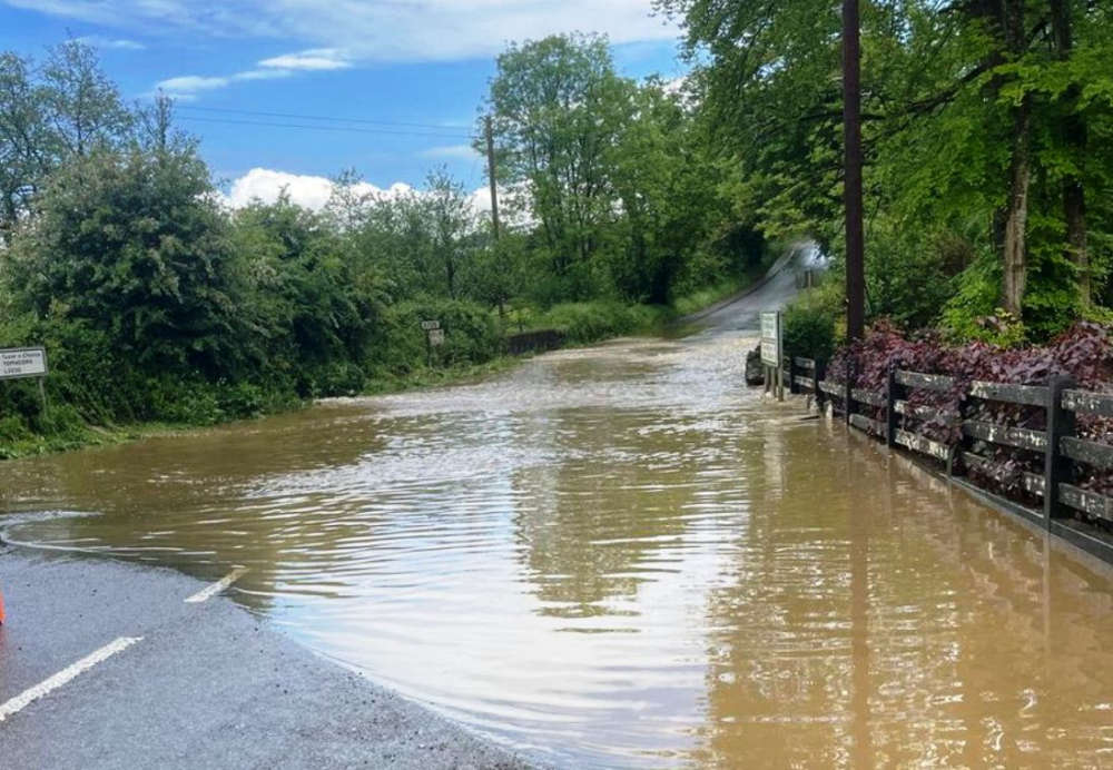
Wicklow was hit hard by Storm Claudia in mid-November after relentless rain left soils saturated and rivers swelling.
The heavy rainfall pushed rivers such as the Avonmore, Avonbeg and Vartry— which all feed into the River Avoca — to their highest or second‑highest peaks on record, with flooding affecting communities in areas including Wicklow Town, Rathdrum, and Roundwood.
The convergence of prolonged wet conditions and intense rainfall made the county especially vulnerable.
The heavy rainfall was not a one‑off. The months leading up to the storm were already unusually wet according to Met Éireann, September was one of the wettest recorded with around 142% of its long‑term average rainfall according to met.ie
A group of researchers from ICARUS, supported by climate scientists at Met Éireann, have carried out a rapid attribution study on the two-day rainfall levels recorded in Dublin, Wexford, and Wicklow on the 14 and 15 November 2025 during Storm Claudia.https://t.co/zlHqbJ2vwF pic.twitter.com/8uGZZYGqIG
— Maynooth University (@MaynoothUni) November 27, 2025
October also saw above‑average rainfall across most of Ireland.The climate context helps explain why Wicklow — especially its rivers fed by upland catchments — is under growing flood risk.
Met Éireann’s dataset shows that rainfall in mountainous and eastern Ireland, including Wicklow, typically sees large year‑to‑year variability.
A rapid climate‑attribution study by ICARUS, supported by Met Éireann, found that two‑day rainfall events in Wicklow are now about 12% heavier compared to a pre‑industrial climate baseline.
Similarly, 30‑day rainfall totals are roughly 7% higher. The study concludes that extreme rainfall events like Storm Claudia are already roughly twice as likely as they would have been in a pre‑industrial climate.
With continued global warming, these trends are expected to worsen. In climate scenarios with 1.5 °C, 2.0 °C, and 3.0 °C warming, two‑day rainfall extremes could intensify by 1%, 3%, and 8% respectively; 30‑day totals could increase 0.5%, 2%, and 4.5%.
@byrnesgifts Main Street Wicklow Town Ireland Today🇮🇪☘️ #wicklow #dublin #ireland #irish #irelandtiktok
♬ original sound - Byrnes Giftware
In a 3.0 °C warmer world, floods like those triggered by Storm Claudia could occur as frequently as once every one to two years — dramatically increasing the flood risk for Wicklow’s river valleys and coastal estuaries.
These findings underscore the urgent need for improved flood‑resilience planning in Wicklow. Towns and villages along the Avonmore, Avonbeg, and Vartry — and ultimately along the Avoca estuary at Arklow — must prepare for more frequent and intense flood events.
This includes updating drainage infrastructure, strengthening early‑warning systems, protecting vulnerable homes and businesses, and restoring natural river catchments where possible.
This research was carried out under the WASITUS project by ICARUS and Met Éireann, in collaboration with the World Weather Attribution team, as part of an effort to build an operational climate‑event attribution capability in Ireland.
 Wicklow Hurlers Dominate Fermanagh To Ramp Up Promotion Hopes
 Survey Shows Wicklow Families Want The Right To Deliver A Funeral Eulogy
 Bray Vet Helps Reunite Wandering Pup with Owners
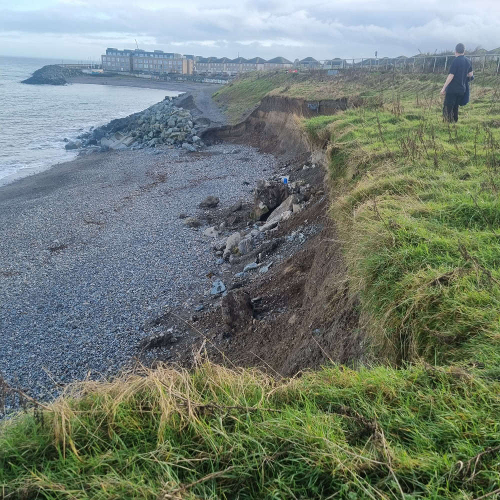 Public Warned: Cliff Walk In Danger Of Collapse
 Wicklow Cultural Icon Katie Taylor Plans Croker Sunset Showdown