

The east coast railway protection plan could now be reconsidered according to reports
New Projects are set to be developed by Irish Rail to protect the DART line from climate change.
Some sections of the coastal railway south of Dublin to Wicklow are vulnerable to the impacts of coastal erosion, coastal flooding, wave overtopping and cliff instability that is expected to increase both in frequency and severity in future years as a result of climate change. More information on the impact of climate change in Ireland is provided at www.climateireland.ie.
The line between Merrion Gates in Dublin and Wicklow Harbour has seen the loss of 20 to 30 metres of coastline in the last 10 years alone.
Iarnród Eireann's project to protect large sections of the Dublin to Rosslare rail line from the effects of climate change, enters its second round of public consultation from today.
The Dublin to Wicklow section of the east coast railway is a critical part of the rail network, with southside DART, Gorey commuter and Rosslare Europort Intercity services operating on this route.
Fianna Fáil Wicklow-Wexford TD Malcolm Byrne has a brief comment:
''This is a major review of the Rosslare rail line to examine further ways to protect it from coastal erosion.
It has serious impact for Co Wicklow and commuters all along the track. As a rail user, it is welcome but more needs to happen.''
Five key locations have been assessed as requiring protection to increase resilience to coastal erosion as a result of climate change. These five locations have been assessed as they have experienced incursions to such levels that existing infrastructure is at risk due to coastal erosion. Each location is being delivered as a standalone project through design, planning and construction.
These five locations are....
Merrion Gates to Seapoint Beach
Whiterock Beach to South Kiliney
Bray Head to Greystones North Beach
Kilcoole to Newcastle
Newcastle to Wicklow Murrough
Bray Head
At Bray Head, the railway runs along cliffs supported by masonry and rock structures. Rock revetments using 6–10 tonne armour rock will be placed on existing rock platforms, with a gravel layer beneath, to reinforce and protect these structures.
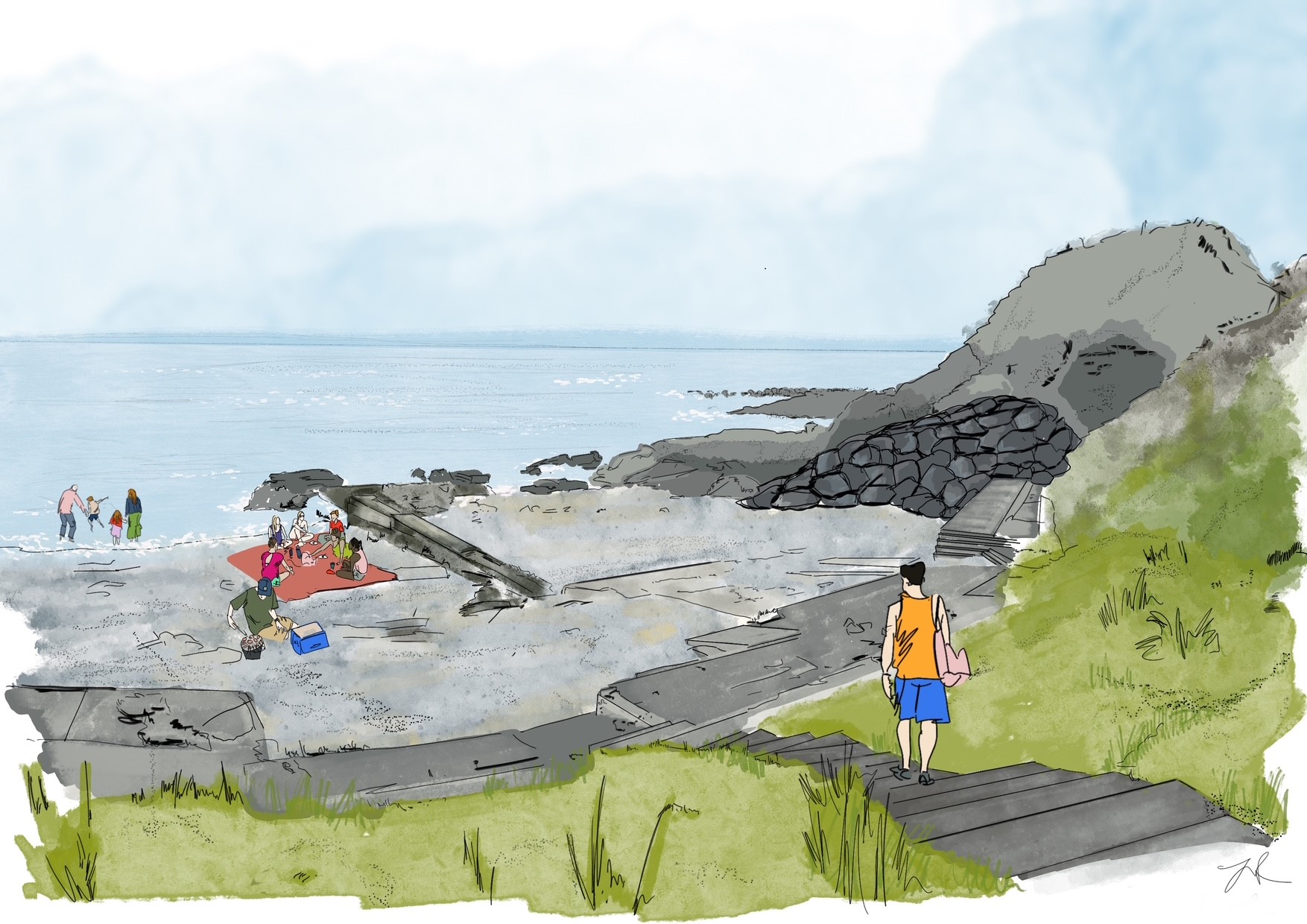
Figure 1: Illustrative view of proposed rock revetment at Naylors Cove
Greystones North Beach
At Greystones North Beach, earlier designs with detached rock headlands were revised for safety and access. Instead, two revetments will be built directly against the cliff to maintain beach access and protect the railway. These will use large armour rock with an underlayer.
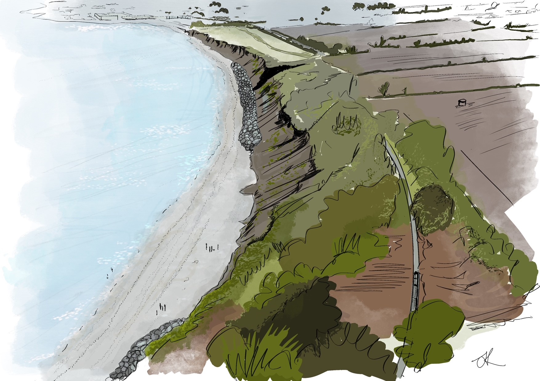
Figure 2: Illustrative view looking south along Greystones North Beach
Kilcoole to Newcastle
This project area spans approximately 4 km between Kilcoole and Newcastle, with proposed works covering 2.5 km of this stretch. The railway is situated on a natural embankment at the back of the beach, which is a soft barrier beach feature underlain by hard geology. The railway is locally protected by rock revetments at Kilcoole Station and at the estuary mouth, known as The Breaches. The project area falls within several designated conservation sites, including The Murrough Special Protection Area and the Murrough Wetland Special Area of Conservation.
Project Objectives
The objectives of the project are:
- To reduce the impacts of wave overtopping on railway infrastructure and operations,
- To reduce the risk of coastal erosion undermining the railway
Preferred Scheme
The preferred scheme involves a rock revetment along parts of the coastline between Kilcoole and Newcastle to protect the railway from erosion and wave overtopping. It will consist of two layers of high-quality armour rock placed over geotextile, with the design tailored using wave models that account for sea level rise.
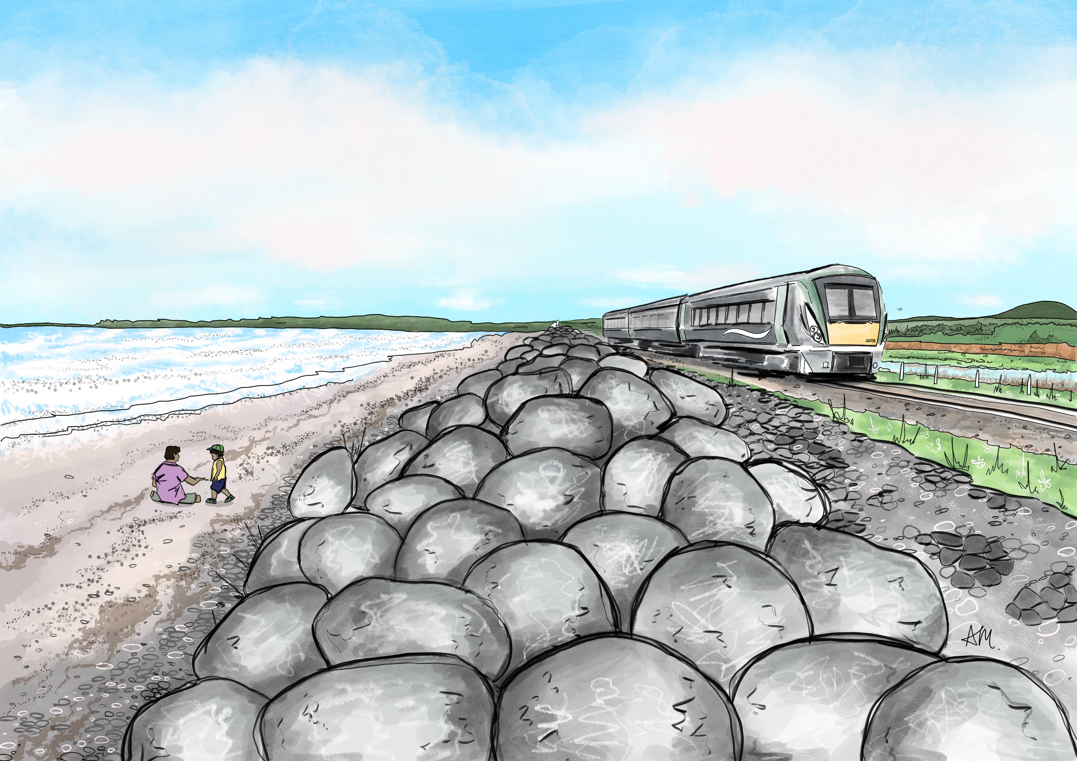
Figure 1: Illustrative view of rock revetment at the Murrough
Concrete Revetment
At The Breaches underbridge, a concrete revetment is proposed instead of rock to reduce predator presence near the Little Tern nesting site. This structure includes a concrete slope, vertical sheet piling, and rock toe protection. Due to concrete’s impermeability, a larger wave wall is required to manage wave run-up and overtopping.
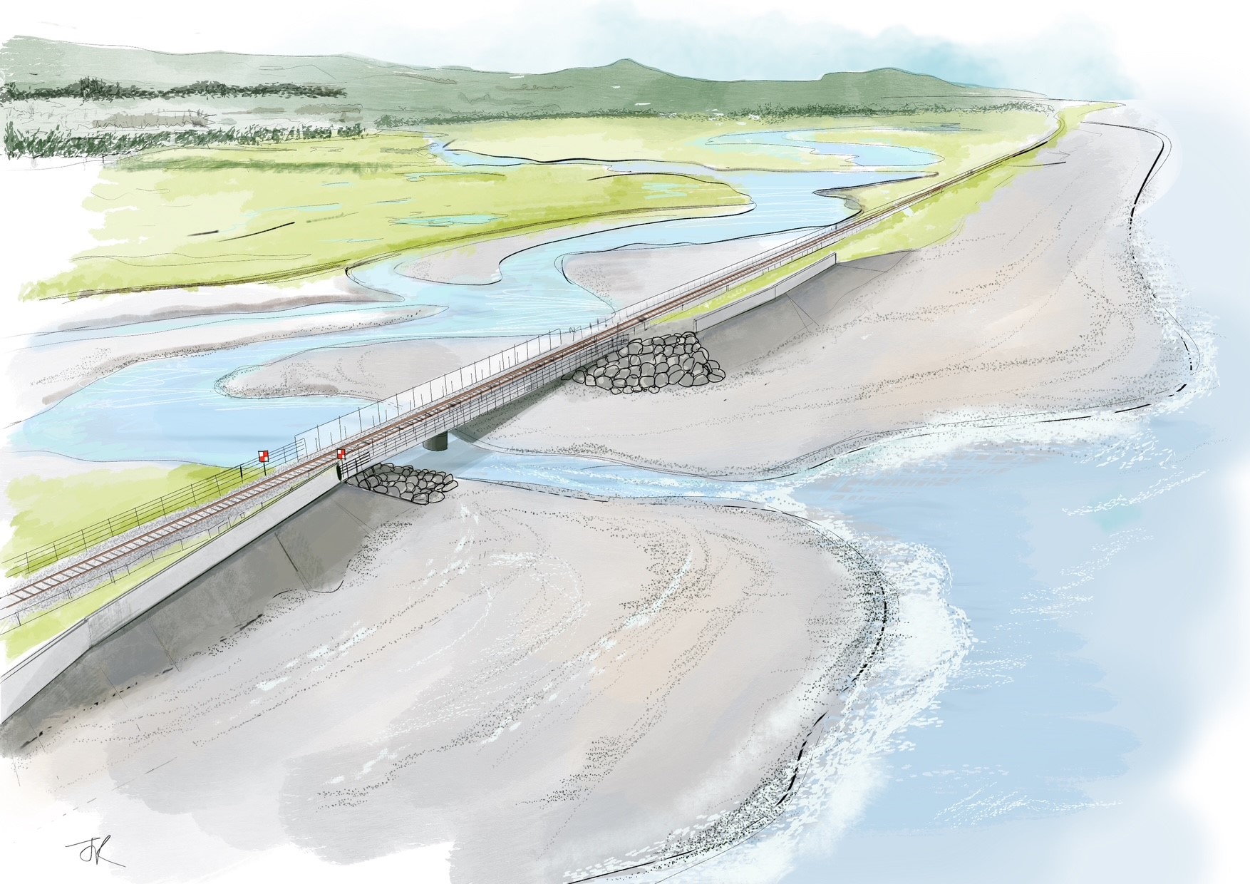
Figure 2: Illustrative view showing the proposed concrete revetments at The Breaches
Wave Walls
Wave walls, made of precast reinforced concrete, will be installed behind most of the revetments to act as impermeable barriers. In areas where the beach is stable, wave walls alone are sufficient, without revetments.
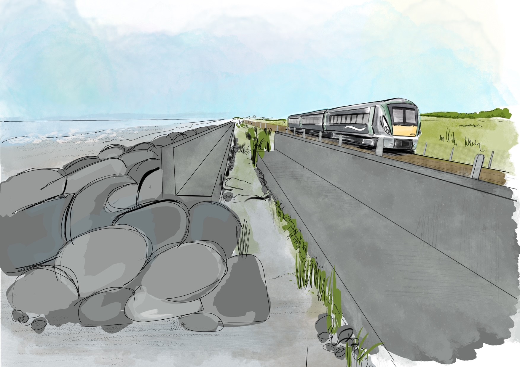
Figure 3: Illustrative view looking South to Newcastle showing the transition from the set back wall to a rock revetment with wave wall
Pedestrian Access
To ensure safe pedestrian access, new precast concrete steps will be added south of The Breaches, while existing steps near Newcastle will be replaced. No new steps are planned between Leamore Lower and Newcastle, where beach access remains open.
A maintenance access ramp will be built near the level crossing south of The Breaches to support ongoing maintenance. It will be secured with a demountable barrier to prevent unauthorised access.
Newcastle to Wicklow Murrough
The project area spans approximately 8 km between Newcastle and Wicklow Murrough, with proposed works covering 4 km of this stretch. The railway is situated on a natural embankment at the back of the beach, which is a soft barrier beach feature underlain by hard geology. The railway is locally protected by rock revetments near Newcastle, Five Mile Point and Wicklow; the remainder is undefended, and some areas have a wide buffer (25-70 metres) between the beach and the railway. The project area falls within several designated conservation sites, including The Murrough Special Protection Area and the Murrough Wetland Special Area of Conservation.
Key hazards include wave overtopping—due to the low-lying railway and narrow beach—and erosion which may cause beach steepening and narrowing, potentially undermining both the rock structures and the railway over time.
Project Objectives
The objectives of the project between Newcastle and Wicklow Murrough are:
- To reduce the impacts of wave overtopping on railway infrastructure and operations,
- To reduce the risk of coastal erosion undermining the railway
Preferred Scheme
The preferred scheme involves a rock revetment along parts of the coastline between Newcastle and Wicklow Murrough to protect the railway from erosion and wave overtopping.
Rock revetment
A rock revetment will be built along parts of the frontage to prevent erosion and reduce wave overtopping onto the railway. It will consist of two layers of graded armour rock over an underlayer and geotextile. The rock is carefully selected for durability and stability, accounting for future sea level rise. The revetment’s design—its slope, height, and width—is calculated to reduce wave overtopping to acceptable limits to protect railway operations.
Figure 2: Illustrative view of rock revetment at The Murrough
Wave wall
At concept design, a concrete wave wall at the rear of the crest between Newcastle and Wicklow Murroughs was recommended to provide an impermeable barrier at the back of the rock revetments.
However, during preliminary design the rock revetment profile was adjusted to better absorb and dissipate wave energy and eliminate the need for a crest wall.
Pedestrian access steps
To ensure safe pedestrian access to and from the beach, the design includes 10 sets of precast concrete steps between Newcastle and Wicklow Murroughs. These steps help prevent beachgoers from being cut off by the tide. Their placement is based on the layout of the coastal defences, with steps spaced approximately every 600 metres, ensuring a maximum 300-metre walk to the nearest exit point.
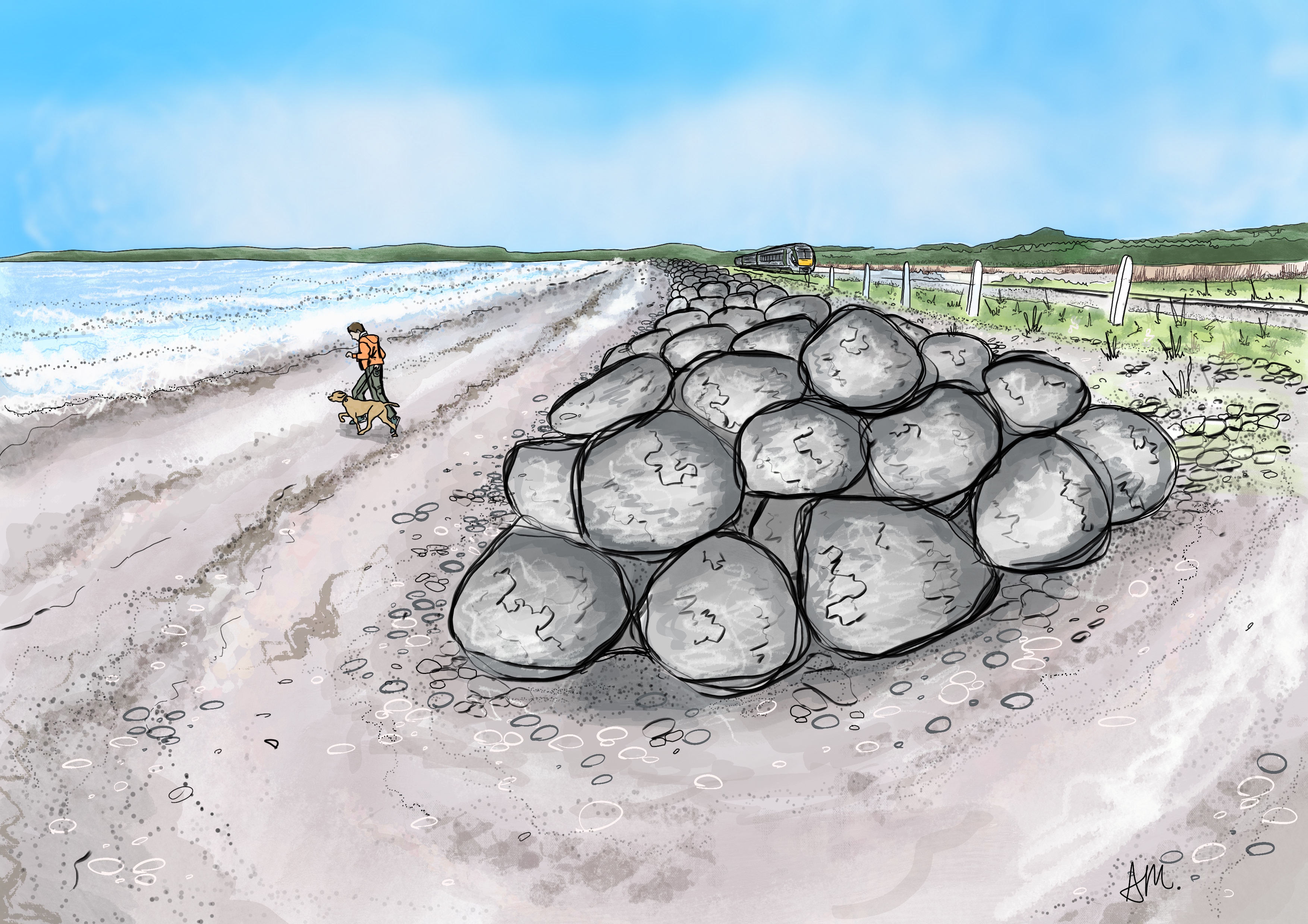
Figure 2: Rock revetment north of The Murrough
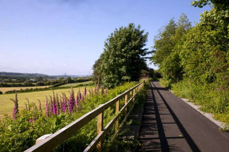 TD Calls For The Government To Get A Move On With South-Wicklow Greenway
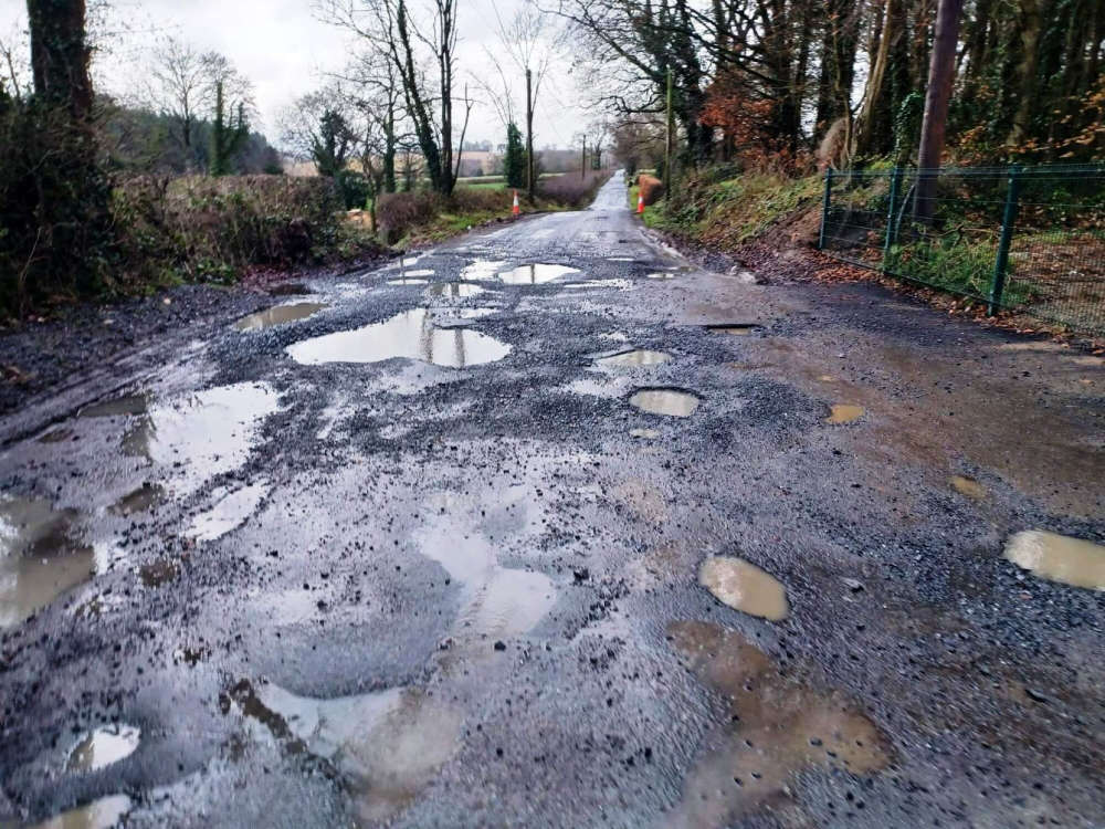 Wicklow Councillors Demand €15m In Emergency Funding For Storm-Damaged Roads
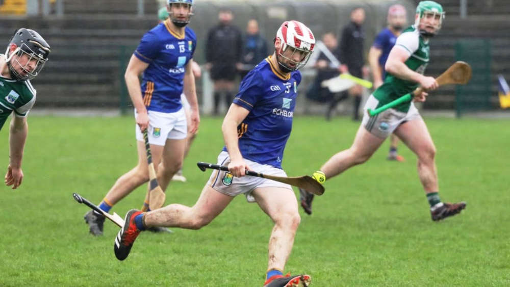 Wicklow Hurlers Dominate Fermanagh To Ramp Up Promotion Hopes
 Survey Shows Wicklow Families Want The Right To Deliver A Funeral Eulogy
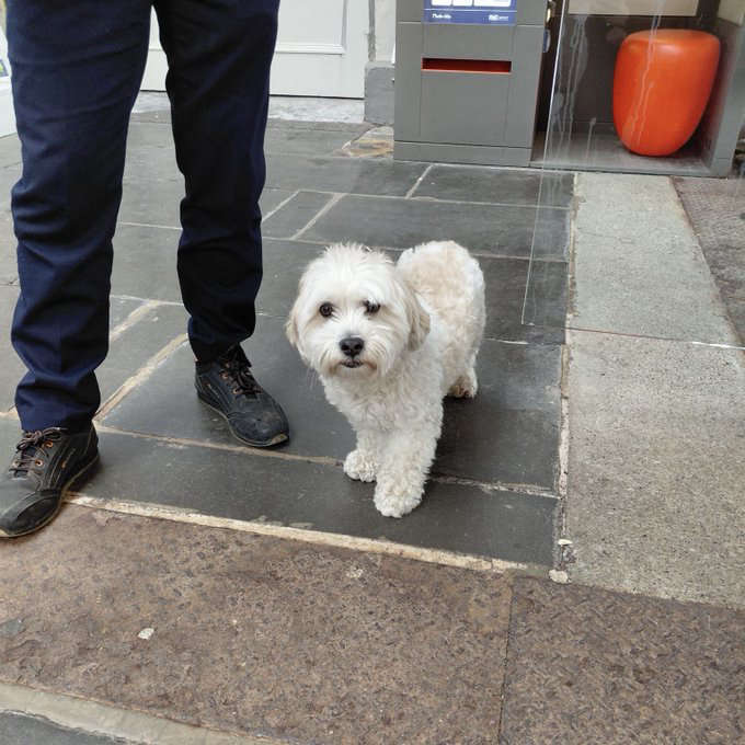 Bray Vet Helps Reunite Wandering Pup with Owners